System
Light
Dark
News
RSS, last 100
Podcast feed of the last two years
SD quality
Podcast audio feed of the last year
Podcast archive feed, everything older than two years
SD quality
News
RSS, last 100
Podcast feed of the last two years
SD quality
Podcast audio feed of the last year
Podcast archive feed, everything older than two years
SD quality
Search for "FOSS4G" returned 312 results
previous page
Sort by
Newest first
Oldest first
Relevance
next page
95 min
QGIS on the road
General
95 min
2019-08-30
678
Matthias Kuhn
FOSS4G 2019
22 min
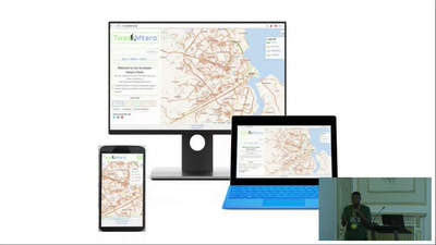
Development of a flood risk monitoring system to support flood risk reduction through…
General
22 min
2019-08-30
51
Edgar Vitus Mlowe
and
Beatrice Charles Mkumbo
FOSS4G 2019
22 min
MapMint: The service-oriented platform
General
22 min
2019-08-28
38
Gérald Fenoy
FOSS4G 2019
30 min
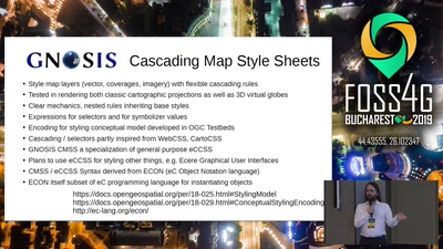
GNOSIS Cartographic Map Style Sheets (CMSS) - an elegant and powerful styling language…
General
30 min
2019-08-30
38
Jerome St-Louis
FOSS4G 2019
12 min
Pivoting to Monetize Mobile Hyperlocal Gamification in the Cloud.. on the Blockchain
Keynote
12 min
2019-08-30
115
Schuyler Erle
FOSS4G 2019
13 min
Four-letter word
Keynote
13 min
2019-08-30
548
Iván Sánchez Ortega
FOSS4G 2019
31 min
Closing ceremony
Keynote
31 min
2019-08-30
78
vasile.craciunescu
FOSS4G 2019
24 min
The European Union's Copernicus program: Europe's eyes on Earth
Keynote
24 min
2019-08-30
98
Francesco Barbato
FOSS4G 2019
21 min
Mapillary Mobile Apps & SDKs
General
21 min
2019-08-28
167
Christopher Beddow
and
Voda Ovidiu
FOSS4G 2019
24 min
QWC2 viewer for QGIS server with micro service architecture
24 min
2019-08-29
540
Pirmin Kalberer
FOSS4G 2019
24 min
QGIS 3D: current state and future plans
24 min
2019-08-30
733
Lutra Consulting
FOSS4G 2019
25 min
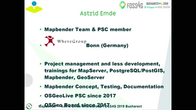
Create Web Application with Mapbender
General
25 min
2019-08-29
495
Astrid Emde
FOSS4G 2019
31 min
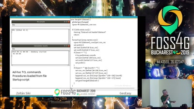
GeoEasy, free surveying calculations
General
31 min
2019-08-29
696
Zoltan Siki
FOSS4G 2019
34 min
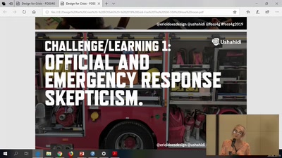
Designing for Crisis
34 min
2019-08-29
37
Eriol Fox
FOSS4G 2019
21 min
Self-replicating Technologies: Open Source & Patents
General
21 min
2019-08-30
25
Sonal Bhoraniya
FOSS4G 2019
26 min
Exploratory study of urban resilience in the region of Stuttgart based on OpenStreetMap…
Academic
26 min
2019-08-29
108
Jörn Birkmann
,
Daniel Feldmeyer
and
Holger Sauter
FOSS4G 2019
21 min
Building a national vector tile set for the Netherlands
General
21 min
2019-08-30
126
Steven Ottens
FOSS4G 2019
26 min
Geopaparazzi state of the art of the digital field mapping application
General
26 min
2019-08-29
94
Andrea Antonello
FOSS4G 2019
24 min
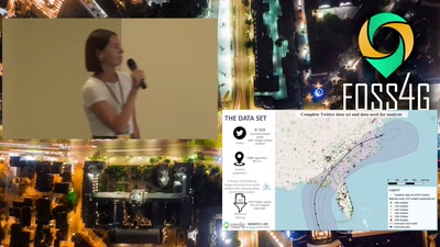
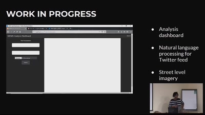
Fast insight about the severity of hurricane impact with spatial analysis of Twitter posts
Academic
24 min
2019-08-30
37
Barbara Pernici
,
Federica Migliaccio
,
Daniela Carrion
and
Katarina Spasenovic
FOSS4G 2019
25 min
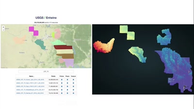
Continental Scale Point Cloud Data Management and Exploitation with Entwine
General
25 min
2019-08-30
1.4k
Connor Manning
FOSS4G 2019
16 min
Developing a GIS-based roads maintenance management system
General
16 min
2019-08-29
140
Laura Mugeha
FOSS4G 2019
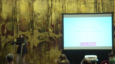
17 min
Metadata catalog Cookbook for Argentina's SDI
General
17 min
2019-08-29
21
Malena Libman
FOSS4G 2019
6 min
OSGeo - Teil einer weltweiten Community OSGeo
Geo
OpenStreeetMap
6 min
2019-03-13
45
Astrid Emde
FOSSGIS 2019
22 min
Lightning Talks Opening
OSM Wiki-Tag History - FOSS4G 2016 - Geopedia - Freie…
22 min
2017-03-22
4
Martin Raifer
,
Till Adams
,
Michael Schön
and
Christian Strobl
FOSSGIS 2017
34 min
Lightning Talks V
Lightning Talks
Pulag
34 min
2025-10-05
11
SotM Working Group
State of the Map 2025
previous page
next page