System
Light
Dark
News
RSS, last 100
Podcast feed of the last two years
SD quality
Podcast audio feed of the last year
Podcast archive feed, everything older than two years
SD quality
News
RSS, last 100
Podcast feed of the last two years
SD quality
Podcast audio feed of the last year
Podcast archive feed, everything older than two years
SD quality
Search for "openstreetmap" returned 664 results
previous page
Sort by
Newest first
Oldest first
Relevance
next page
30 min
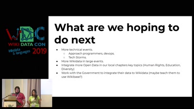
Surviving marriage using Wikidata
30 min
2019-10-26
57
Nicolás Giorgetti
and
Ivana Molena
WikidataCon 2019
28 min
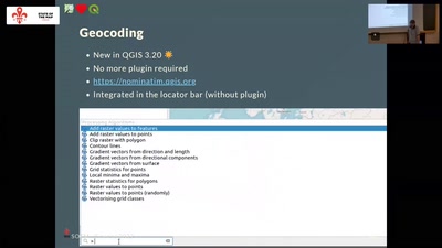
State of OSM in QGIS
Cartography
OSM
28 min
2022-08-20
74
Etienne Trimaille
State of the Map 2022
32 min
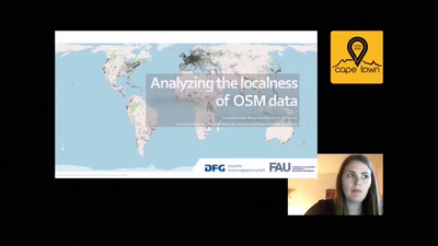
Analyzing the localness of OSM data
OSM
32 min
2020-07-05
183
Susanne Schröder-Bergen
State of the Map 2020
27 min
Generalisierung von OSM-Daten mit osm2pgsql
Kartographie und Visualisierung
27 min
2023-03-16
106
Jochen Topf
FOSSGIS 2023
4 min
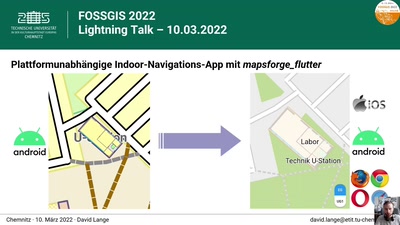
Platformunabhängige Indoor-Navigations-App mit mapsforge_flutter
Neuigkeiten aus den Open-Source-Projekten
Geo
4 min
2022-03-10
110
David Lange
FOSSGIS 2022
30 min
Code for Germany. Gute Taten mit offenen Daten
Community
WikiPakaWG
30 min
2019-12-27
1.8k
Julia
36C3: Resource Exhaustion
17 min
OpenMapTiles: news, thematic layers, and coordinate systems
17 min
2019-08-30
60
Petr Sloup
,
Dalibor Janak
and
Petr Pridal
FOSS4G 2019
24 min
Stand der Hausnummern in OSM und Hausnummerauswertung auf regio-osm.de
Freie Daten
GI Studio
24 min
2016-07-05
0
Dietmar Seifert
FOSSGIS 2016
25 min
Qualitätssicherung mit Vektortiles
Freie Daten
25 min
2017-03-22
3
Michael Reichert
FOSSGIS 2017
29 min
PostGIS in Action
Optimierte Datenbanken für Online-Stadtpläne
Freie Software
29 min
2017-03-23
25
Oliver Tonnhofer
FOSSGIS 2017
24 min
Transitous - Free and Open Public transport routing
Open-Data
HS i7
24 min
2026-04-11
377
Volker Krause
Grazer Linuxtage 2026
16 min
maplibre-rs: Cross-platform Map Rendering using Rust
Cartography
OSM
16 min
2022-08-19
267
Max Ammann
State of the Map 2022
39 min
Datenpumpen-Hackathon #01
39 min
2018-12-27
291
John
and
Lucas
35C3: wikipakawg
41 min
With Great Power Comes Great Responsibility
Mapping
OSM
41 min
2021-07-10
131
Frederik Ramm
State of the Map 2021
26 min
Assisted Intelligence - How we map with the support of new technologies
Mapping
StateoftheMap
26 min
2019-09-21
84
Felix Delattre
and
Surabhi Singh
State of the Map 2019
22 min
VR Map: Using OSM Data In a WebVR Environment
User Experiences
StateoftheMap
22 min
2019-09-21
156
Robert Kaiser
State of the Map 2019
29 min
Produktion generalisierter Eisenbahnkarten
Geo
OpenStreeetMap
29 min
2019-03-15
138
Alexander Matheisen
FOSSGIS 2019
30 min
fAIrSwipe
Software Development
Mayon
30 min
2025-10-04
12
Omran NAJJAR
State of the Map 2025
45 min
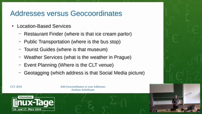
Füge Geokoordinaten zu deinen Adressen in PostgreSQL hinzu
Vortrag
45 min
2024-03-16
119
Andreas Scherbaum
Chemnitzer Linux-Tage 2024
28 min
osm2streets: Street networks with detailed geometry
Software Development
OSM
28 min
2022-08-21
159
Dustin Carlino
State of the Map 2022
40 min
What Makes Bike-Sharing Work?
Insights from 43 Million Kilometers of European Cycling Data
Science
One
40 min
2025-12-29
5.9k
Martin Lellep
,
Georg Balke
and
Felix Waldner
39C3: Power Cycles
24 min
Awesome (OSM) Games
User Experiences
Mayon
24 min
2025-10-03
622
Ben Hur Pintor
State of the Map 2025
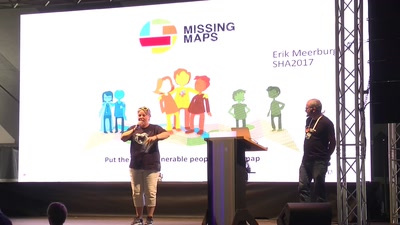
37 min
One map to map them all
Why MissingMaps saves lives, and how to help
37 min
2017-08-05
127
Erik Meerburg
SHA2017: Still Hacking Anyway
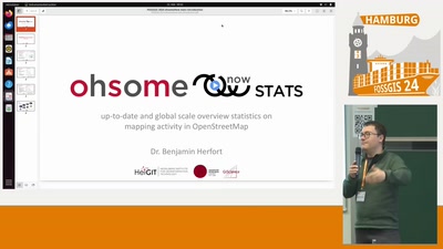
4 min
ohsomeNow: OSM-Daten in Echtzeit analysieren
OpenStreetMap
4 min
2024-03-22
88
Benjamin Herfort
FOSSGIS 2024
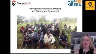
38 min
Participatory Budgeting & Mapping with citizens and government
Mapping
38 min
2020-07-04
30
Lucy Fondo
and
Erica Hagen
State of the Map 2020
previous page
next page