System
Light
Dark
News
RSS, last 100
Podcast feed of the last two years
SD quality
Podcast audio feed of the last year
Podcast archive feed, everything older than two years
SD quality
News
RSS, last 100
Podcast feed of the last two years
SD quality
Podcast audio feed of the last year
Podcast archive feed, everything older than two years
SD quality
Search for " %s" returned 10000 results
previous page
Sort by
Newest first
Oldest first
Relevance
next page
25 min
Revamp of Coordinate Reference System management in the OSGeo C/C++ stack with PROJ and…
General
25 min
2019-08-28
205
Even Rouault
FOSS4G 2019
13 min
Interactive map of geospatial information in the City of Buenos Aires
General
13 min
2019-08-28
28
Ariel Anthieni
FOSS4G 2019
26 min
INSPIRE Reference Validator: status and next steps
General
26 min
2019-08-28
48
Belén Sáez
,
Iñaki Díaz de Cerio Paniagua
,
Carlos Palma
,
Enrique Soriano
,
Jon Herrmann
,
Clemens Portele
,
Michael Lutz
and
Marco Minghini
FOSS4G 2019
22 min
GeoServer WFS3: introduction to the RESTful, schemaless, JSON first download service
General
22 min
2019-08-28
487
Andrea Aime
FOSS4G 2019
20 min
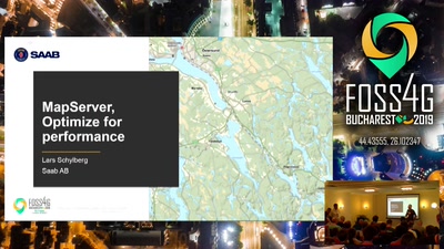
MapServer, Optimize for performance
General
20 min
2019-08-28
129
Lars Schylberg
FOSS4G 2019
23 min
Publication of Inspire Datasets as Linked Data
General
23 min
2019-08-28
39
Enrique Soriano
and
Rodríguez Pascual Antonio Federico
FOSS4G 2019
21 min
Data is USELESS!
General
21 min
2019-08-28
52
Lars Agerskov Christensen
FOSS4G 2019
28 min
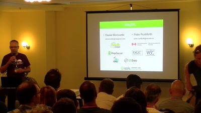
MapML: The (new) "map" HTML element, now in MapServer, GDAL and OGR
General
28 min
2019-08-28
130
Daniel Morissette
and
Peter Rushforth
FOSS4G 2019
24 min
FOSS tools for modelling natural hazards: the HortonMachine library
General
24 min
2019-08-28
31
Silvia Franceschi
FOSS4G 2019
28 min
G3W-SUITE: a new framework for the QGIS projects WEB publication.
General
28 min
2019-08-28
236
Lami Leonardo
FOSS4G 2019
28 min
When building, maintaining & continuously improving a SDI isn’t enough: DevOps processes…
General
28 min
2019-08-28
37
Markus Neteler
,
Emmanuel Belo
,
Torsten Drey
and
Marc Jansen
FOSS4G 2019
24 min
Interactive GeoPlatform for Public Administrations
General
24 min
2019-08-28
44
Andrea Pogliaghi
and
E. Cattaneo
FOSS4G 2019
23 min
One click data publishing for QGIS to support OGC/INSPIRE
General
23 min
2019-08-28
169
Jody Garnett
and
Paul van Genuchten
FOSS4G 2019
21 min
Visual Hierarchies in 3D Cartography with vts-geospatial
General
21 min
2019-08-28
119
Ondřej Procházka
FOSS4G 2019
23 min
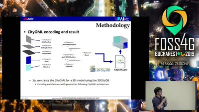
Current Status of mago3D, an Open Source Based Digital Twin Platform
General
23 min
2019-08-28
162
Sanghee Shin
FOSS4G 2019
25 min
Complying with administrative data model requirements like INSPIRE, a Swiss perspective
General
25 min
2019-08-28
33
Matthias Kuhn
FOSS4G 2019
21 min
JuliaGeo: A Fresh Approach to Geospatial Computing
General
21 min
2019-08-28
536
Maarten Pronk
and
Martijn Visser
FOSS4G 2019
17 min
Finding Sasquatch or how to fake a moon landing
General
17 min
2019-08-28
43
James Banting
FOSS4G 2019
21 min
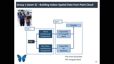
PinSout: Accelerating 3D Indoor Space Construction from Point Clouds with Deep Learning
General
21 min
2019-08-28
134
Kyoung-Sook Kim
FOSS4G 2019
28 min
Planet - how GIS/RS users can leverage the product and services
General
28 min
2019-08-28
20
Robert Nagy
FOSS4G 2019
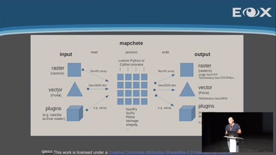
29 min
Mapchete - tile-based geodata processing
General
29 min
2019-08-28
86
Joachim Ungar
FOSS4G 2019
20 min
State of MapServer
General
20 min
2019-08-28
153
Seth Girvin
,
Daniel Morissette
and
Michael Smith
FOSS4G 2019
20 min
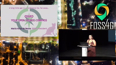
OSGeo: Your Open Source Compass
Keynote
20 min
2019-08-28
102
María Arias de Reyna Domínguez
FOSS4G 2019
19 min
inous Initiative - An eco-system for OGC IndoorGML
General
19 min
2019-08-28
50
Do-Hun Kang
,
Byeong-Gon Kim
,
Yongsu Song
and
Ki-Joune Li
FOSS4G 2019
27 min
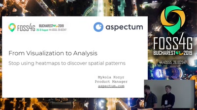
From visualization to analysis. Stop using heatmaps to discover spatial patterns
General
27 min
2019-08-28
666
Mykola Kozyr
FOSS4G 2019
previous page
next page