System
Light
Dark
News
RSS, last 100
Podcast feed of the last two years
SD quality
Podcast audio feed of the last year
Podcast archive feed, everything older than two years
SD quality
News
RSS, last 100
Podcast feed of the last two years
SD quality
Podcast audio feed of the last year
Podcast archive feed, everything older than two years
SD quality
Search for "%s" returned 10000 results
previous page
Sort by
Newest first
Oldest first
Relevance
next page
26 min
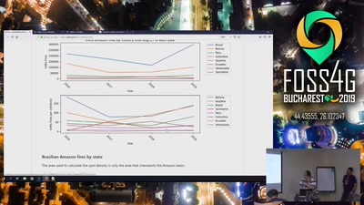
The return of Crazy Data - Fires in the Amazon forest
General
26 min
2019-08-30
243
Daniel Araújo Miranda
FOSS4G 2019
20 min
Social Dynamics in Urban Context (SoDUCo) : Open tools, models, and data – Paris and its…
General
20 min
2019-08-30
46
Bertrand Duménieu
and
Pierre-André Le Ny
FOSS4G 2019
21 min
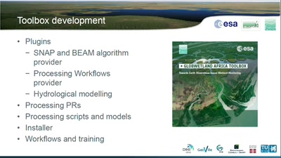
GlobWetland Africa Toolbox: Implementing Earth Observation based Wetland Monitoring…
General
21 min
2019-08-30
40
Radoslaw Guzinski
FOSS4G 2019
21 min
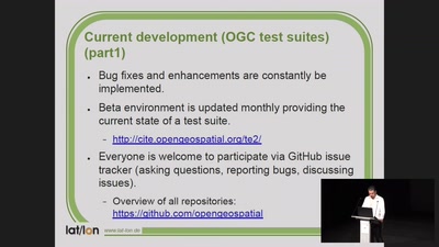
TEAM Engine - Validation of new OGC standard WFS 3.0 and status update of project
General
21 min
2019-08-30
41
Dirk Stenger
FOSS4G 2019
28 min
Human Geography with Open GIS as a Transformative Introductory Higher Education Course
Academic
28 min
2019-08-30
35
Joseph Holler
FOSS4G 2019
22 min
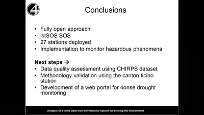
An open drought monitoring system for the Deduru Oya basin in Sri Lanka in the context of…
Academic
22 min
2019-08-30
28
Bopagoda Hettiarachchige Sudantha
,
Rangajeewa Ratnayake
,
Emeshi Warusavitharana
,
Daniele Strigaro
and
Massimiliano Cannata
FOSS4G 2019
18 min
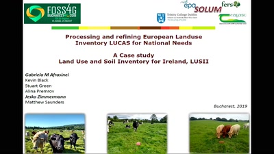
Processing and refining European Land use Inventory LUCAS for National Needs: A Case…
General
18 min
2019-08-30
59
Gabriela Afrasinei
FOSS4G 2019
14 min
Case Study of Data Collection & Data Sharing for Rural Water Supply Management in Rwanda
General
14 min
2019-08-30
351
Larissa Dusabe
and
Jin Igarashi
FOSS4G 2019
28 min
A COG In The Machine - Using Cloud Optimised GeoTiffs to Query 24 Billion Pixels In…
General
28 min
2019-08-30
197
Tomas Holderness
FOSS4G 2019
22 min
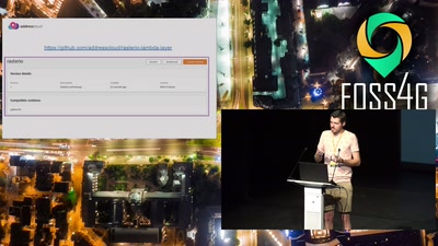
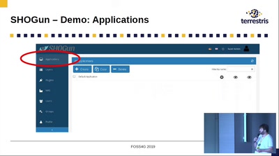
SHOGun, GeoServer & QGIS Integration: Manage WebGIS Applications from your Desktop
General
22 min
2019-08-30
328
Till Adams
FOSS4G 2019
27 min
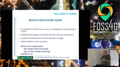
Streaming and rendering the Turin 3D geospatial content through GIS and BIM integration
General
27 min
2019-08-30
98
Fabrizio Massara (CSI Piemonte)
,
Fabrizio Provera
and
Adelaide Ramassotto (CSI Piemonte)
FOSS4G 2019
19 min
Flood Vulnerability Index for coastal communities linked to mangrove forests based on the…
General
19 min
2019-08-30
29
María Fernanda Peña Valencia
FOSS4G 2019
25 min
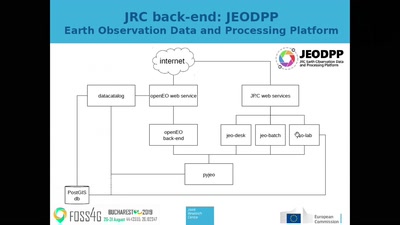
Implementing an openEO compliant back-end for processing data cubes on the JEODPP
General
25 min
2019-08-30
44
Pieter Kempeneers
FOSS4G 2019
26 min
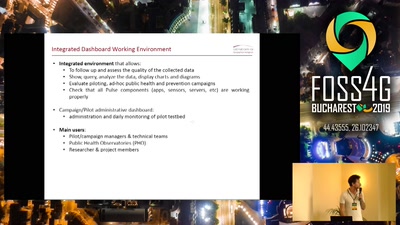
The case of PULSE: fostering sustainable environments using geodata with a participatory…
General
26 min
2019-08-30
21
Andrea Pogliaghi
FOSS4G 2019
95 min
QGIS on the road
General
95 min
2019-08-30
678
Matthias Kuhn
FOSS4G 2019
22 min
Development of a flood risk monitoring system to support flood risk reduction through…
General
22 min
2019-08-30
51
Edgar Vitus Mlowe
and
Beatrice Charles Mkumbo
FOSS4G 2019
30 min
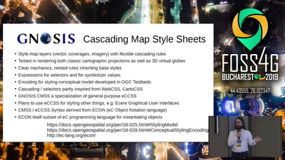
GNOSIS Cartographic Map Style Sheets (CMSS) - an elegant and powerful styling language…
General
30 min
2019-08-30
38
Jerome St-Louis
FOSS4G 2019
26 min
Awards ceremony
Keynote
26 min
2019-08-30
184
vasile.craciunescu
FOSS4G 2019
25 min
How Open is Revolutionizing Science
Keynote
25 min
2019-08-30
135
Matthew Hanson
FOSS4G 2019
13 min
Four-letter word
Keynote
13 min
2019-08-30
548
Iván Sánchez Ortega
FOSS4G 2019
31 min
Closing ceremony
Keynote
31 min
2019-08-30
78
vasile.craciunescu
FOSS4G 2019
25 min
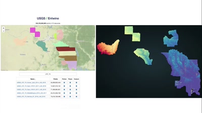
Continental Scale Point Cloud Data Management and Exploitation with Entwine
General
25 min
2019-08-30
1.4k
Connor Manning
FOSS4G 2019
24 min
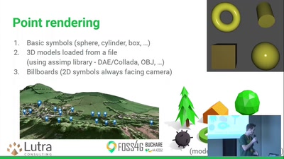
QGIS 3D: current state and future plans
24 min
2019-08-30
733
Lutra Consulting
FOSS4G 2019
22 min
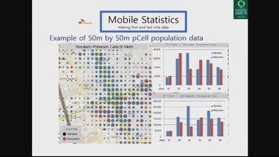
Establishing a Sharing Port for Shared Mobility Services by Analyzing Last Mile Commuting…
General
22 min
2019-08-29
29
Junyoung Choi
FOSS4G 2019
22 min
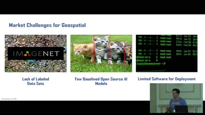
SpaceNet: Automation Levels for Foundational Mapping
General
22 min
2019-08-29
36
Ryan Lewis
FOSS4G 2019
previous page
next page