System
Light
Dark
News
RSS, last 100
Podcast feed of the last two years
SD quality
Podcast audio feed of the last year
Podcast archive feed, everything older than two years
SD quality
News
RSS, last 100
Podcast feed of the last two years
SD quality
Podcast audio feed of the last year
Podcast archive feed, everything older than two years
SD quality
Search for "FOSS4G" returned 312 results
previous page
Sort by
Newest first
Oldest first
Relevance
next page
19 min
Evidence based decision making: open source opportunities to drive global change
19 min
2019-08-28
71
Steven Ramage
FOSS4G 2019
18 min
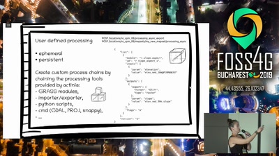
GRASS GIS in the cloud: actinia geoprocessing
18 min
2019-08-28
91
Carmen Tawalika
and
Markus Neteler
FOSS4G 2019
18 min
OpenEO: Earth Observation data cubes
18 min
2019-08-28
357
Jeroen Dries
FOSS4G 2019
26 min
State of GeoServer 2019
26 min
2019-08-28
1.1k
Andrea Aime
and
Jody Garnett
FOSS4G 2019
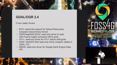
26 min
State of GDAL
26 min
2019-08-28
531
Even Rouault
FOSS4G 2019
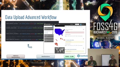
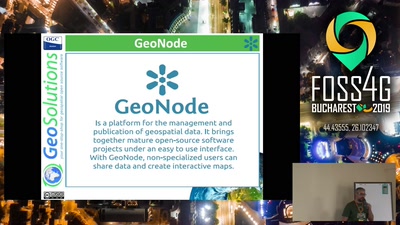
26 min
State of GeoNode
26 min
2019-08-28
243
Alessio Fabiani
FOSS4G 2019
20 min
mapillary2osm: OpenStreetMap Data from Computer Vision
20 min
2019-08-28
185
Edoardo Neerhut
FOSS4G 2019
22 min
One Geonode, many Geonodes
22 min
2019-08-28
157
Alessio Fabiani
FOSS4G 2019
24 min
Introduction to MapStore, mashups made simple
24 min
2019-08-28
231
Mauro Bartolomeoli
FOSS4G 2019
21 min
Show me the good grass: an open GIS powered call center for livestock herders in Mali.
21 min
2019-08-28
65
Alex Orenstein
FOSS4G 2019
25 min
A digital 3D maquette on country scale with pointclouds, postgis, 3D tiles and cesium
25 min
2019-08-28
204
Tom van Tilburg & Anne Blankert
FOSS4G 2019
20 min
Resilience Academy as a sustainability solution for urban resilience skills development…
General
20 min
2019-08-28
19
Msilikale Msilanga
FOSS4G 2019
19 min
How open-source software made CubeSatData.com possible
General
19 min
2019-08-28
27
Matthew Hanson
FOSS4G 2019
26 min
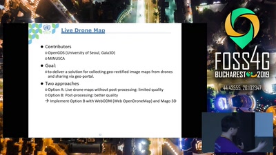
The UN Open GIS initiative – Spiral 4 for geospatial data collection
General
26 min
2019-08-28
28
Yong-Bok Choi
,
Byeong-Gon Kim
,
Impyeong Lee
,
Kwang Woo Nam
,
Jong-Hoon Lee
,
Anandavel Kannan
and
Ki-Joune Li
FOSS4G 2019
28 min
Composing and securing spatial data interfaces. When? Why? How? Serverless edition.
General
28 min
2019-08-28
107
Dennis Bauszus
FOSS4G 2019
17 min
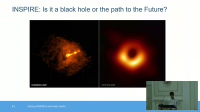
INSPIRE as an Open Platform
General
17 min
2019-08-28
78
Akshat Bajaj
FOSS4G 2019
22 min
GeoServer feature frenzy
General
22 min
2019-08-28
368
Andrea Aime
and
Jody Garnett
FOSS4G 2019
23 min
An OSM-based 3D Street Map of the Earth
General
23 min
2019-08-28
182
Ladislav Horký
FOSS4G 2019
21 min
SAGA GIS 7.3 - new LTR
General
21 min
2019-08-28
100
Johan Van de Wauw
FOSS4G 2019
27 min
Breaking the curse of raster processing software-as-a-service
General
27 min
2019-08-28
247
Iván Sánchez Ortega
FOSS4G 2019
22 min
Establishing a Sharing Port for Shared Mobility Services by Analyzing Last Mile Commuting…
General
22 min
2019-08-29
29
Junyoung Choi
FOSS4G 2019
22 min
SpaceNet: Automation Levels for Foundational Mapping
General
22 min
2019-08-29
36
Ryan Lewis
FOSS4G 2019
19 min
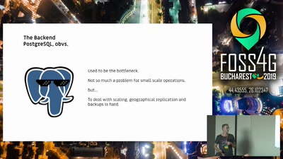
Running QGIS Server in production
General
19 min
2019-08-29
2.6k
Eric Lemoine
FOSS4G 2019
14 min
Cesium applications made awesome with TerriaJS
General
14 min
2019-08-29
384
Stephen Davies
FOSS4G 2019
20 min
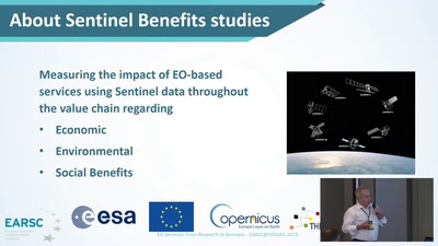
EO Services: From Research to Business
General
20 min
2019-08-29
23
Kamen Iliev
FOSS4G 2019
previous page
next page