System
Light
Dark
News
RSS, last 100
Podcast feed of the last two years
SD quality
Podcast audio feed of the last year
Podcast archive feed, everything older than two years
SD quality
News
RSS, last 100
Podcast feed of the last two years
SD quality
Podcast audio feed of the last year
Podcast archive feed, everything older than two years
SD quality
Search for "openstreetmap" returned 664 results
previous page
Sort by
Newest first
Oldest first
Relevance
next page
30 min
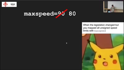
Inferring default speed limits
Software Development
OSM
30 min
2022-08-19
771
Tobias Zwick
State of the Map 2022
31 min
OSM Carto as vector tiles
Cartography
OSM
31 min
2022-08-19
244
Wladimir Szczerban
and
Jiri Komarek
State of the Map 2022
30 min
The Open Show - Große Premiere!
WikiPaka
30 min
2020-12-27
897
jakob
,
pajowu
,
joliyea
and
jnnk
Remote Chaos Experience
32 min
Lightning Talks IV
sotm2024
Lightning Talks
32 min
2024-09-08
8
SotM Working Group
State of the Map 2024
39 min
Lightning Talks III
sotm2024
Lightning Talks
39 min
2024-09-08
40
SotM Working Group
State of the Map 2024
5 min
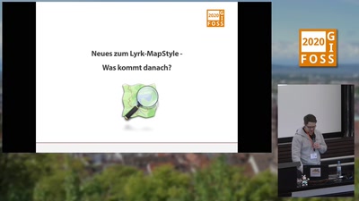
Neues zum Lyrk-Mapstyle; Was kommt danach?
Geo
OpenStreeetMap
5 min
2020-03-13
64
Robert Klemm
FOSSGIS 2020
3 min
Maptime Salzburg - Ein Meetup für Geo-Themen
Geo
OpenStreeetMap
3 min
2019-03-15
39
Jakob Miksch
FOSSGIS 2019
26 min
Analyse und Visualisierung von Polizeimeldungen: Eine Fallstudie für Frankfurt a. M.
Daten, Datenbanken und Datenprozessierung
26 min
2024-03-21
271
Johannes Frank
FOSSGIS 2024
36 min
Lightning Talks II
Community and Foundation
OSM
36 min
2021-07-10
49
SotM Working Group
State of the Map 2021
15 min
Platinum Sponsor Session: OSM Data for Two-Wheelers and Safety
Platinum Sponsor Sessions
Pulag
15 min
2025-10-03
4
Soh Leng
State of the Map 2025
26 min
Kort
Vorträge (OSM)
3.008
26 min
2013-06-13
0
Stefan Oderbolz
FOSSGIS 2013
16 min
Tatort Niederbayern
Vorträge (OSM)
H3
16 min
2014-03-20
0
Alexander Lehner
,
Peter Barth
and
Tobias Knerr
FOSSGIS 2014
26 min
Straßenrennen in der Innenstadt
Vorträge (OSM)
S1
26 min
2015-03-12
2
Tobias Knerr
FOSSGIS 2015
24 min
Feuerwehreinsatzkarten mit OSM
Wenn es brennt, eilt es! – Karten sollen für die Anfahrt…
Freie Daten
24 min
2017-03-23
58
Roman Härdi
FOSSGIS 2017
22 min
The OSM Spectrum
sotm2024
User Experiences
22 min
2024-09-06
62
Pragya Pant
and
Rabina Poudyal
State of the Map 2024
29 min
Am Puls der Zeit
Vorträge (OSM)
Hörsaal 04/114
29 min
2012-03-21
0
Frederik Ramm
FOSSGIS 2012
30 min
Overpass Turbo goes PostGIS
OpenStreetMap
HS1 (Aula)
30 min
2025-03-27
257
Frederik Ramm
FOSSGIS 2025
57 min
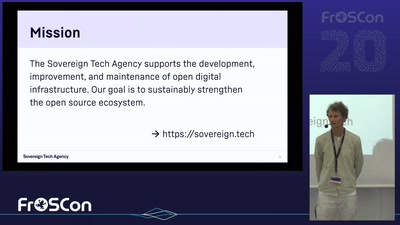
Inside Sovereign Tech Fellowships
Am Lagerfeuer mit Sarah und Stefan
Clouds over Europe - Digital Soverignty and broken promises
HS 8
57 min
2025-08-16
152
Mirko Swillus
,
Sarah Hoffmann
and
Stefan Eissing
FrOSCon 2025
28 min
PMTiles - das cloud-native Format für Kacheln
Daten, Datenbanken und Datenprozessierung
HS2 (S10)
28 min
2025-03-28
166
Pirmin Kalberer
FOSSGIS 2025
27 min
Address and street name grids in the Philippines
Mapping
Mayon
27 min
2025-10-05
6
Dan Jacobson
State of the Map 2025
23 min
Journey to the Center of the Planet
Software Development
Mayon
23 min
2025-10-04
37
Minh Nguyễn
State of the Map 2025
27 min
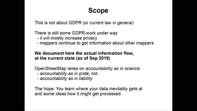
Mapper's privacy
OSM Basics
StateoftheMap
27 min
2019-09-22
51
Roland Olbricht
State of the Map 2019
32 min
Broken Promises and Technical Difficulties
Data Analysis & Data Model
StateoftheMap
32 min
2019-09-22
127
Ilya Zverev
State of the Map 2019
22 min
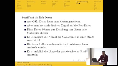
Erfassung der Düsseldorfer Gasbeleuchtung
Geo
OpenStreeetMap
22 min
2019-03-15
89
Harald Schwarz
FOSSGIS 2019
26 min
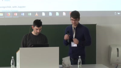
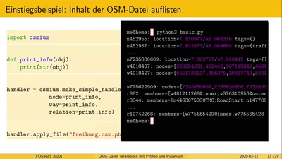
OSM-Daten verarbeiten mit Python und Pyosmium
Geo
OpenStreeetMap
26 min
2020-03-12
270
Sarah Hoffmann
FOSSGIS 2020
previous page
next page