System
Light
Dark
News
RSS, last 100
Podcast feed of the last two years
SD quality
Podcast audio feed of the last year
Podcast archive feed, everything older than two years
SD quality
News
RSS, last 100
Podcast feed of the last two years
SD quality
Podcast audio feed of the last year
Podcast archive feed, everything older than two years
SD quality
Search for "openstreetmap" returned 664 results
previous page
Sort by
Newest first
Oldest first
Relevance
next page
23 min
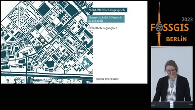
Verwendung von OSM-Daten zur Kartierung des urbanen, öffentlichen Raums
Kartographie und Visualisierung
23 min
2023-03-17
169
Ester Scheck
FOSSGIS 2023
34 min
Lightning Talks I
sotm2024
Lightning Talks
34 min
2024-09-06
22
SotM Working Group
State of the Map 2024
24 min
Und immer wieder Lizenz(in)kompatibilitäten
Open Data, Datenschutz und Lizenzen
24 min
2024-03-22
146
Falk Zscheile
FOSSGIS 2024
25 min
OSM and indoor data
Software Development
OSM
25 min
2022-08-21
105
Clement Igonet
State of the Map 2022
24 min
Satellite Imagery for Social Good - Our Reflections
Mapping
OSM
24 min
2022-08-20
53
Shamilah Nassozi
State of the Map 2022
29 min
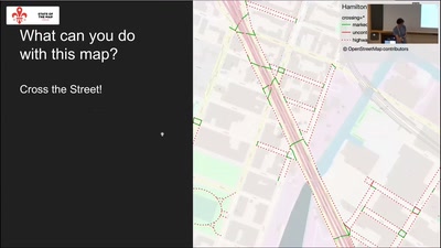
Pedestrian and Bike Mapping in New York City
Mapping
OSM
29 min
2022-08-20
110
Ariel Kadouri
State of the Map 2022
25 min
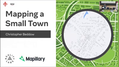
Mapping a Small Town
Mapping
OSM
25 min
2022-08-19
201
Christopher Beddow
State of the Map 2022
21 min
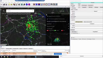
Geodaten im Einsatzleitsystem
OpenStreetMap
Geo
21 min
2021-06-09
142
Michael Schmid
FOSSGIS 2021
5 min
Ein Lastenfahrrad-Routing und -Index: CargoRocket
OpenStreetMap
Geo
5 min
2021-06-09
80
Henri Chilla
FOSSGIS 2021
26 min
Import detaillierter Daten zur barrierefreien Nutzung von Bahnhöfen und Haltestellen
OpenStreetMap
Geo
26 min
2021-06-08
54
Dietmar Seifert
FOSSGIS 2021
14 min
Lightning Poster Talks
Academic
StateoftheMap
14 min
2019-09-22
14
Patricia Solís
,
Everton Bortolini
and
Patricia Solís
State of the Map 2019
23 min
Haltestellen Import in der Schweiz
Vorträge (OSM)
Kleiner Hörsaal Geb. 308
23 min
2011-04-06
2
Michael Spreng
FOSSGIS 2011
31 min
Die Einsatzkarte
Vorträge (OSM)
H3
31 min
2014-03-21
5
Claus Vathauer
FOSSGIS 2014
52 min
Lightning Talks II
sotm2024
Lightning Talks
52 min
2024-09-07
18
SotM Working Group
State of the Map 2024
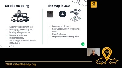
28 min
The Map in 360
Mapping
28 min
2020-07-04
110
Said Turksever
State of the Map 2020
41 min
Lightning Talks I
OSM Basics
41 min
2020-07-04
32
SotM Working Group
State of the Map 2020
20 min
Smarte Wege im Chaos: Echtzeit-Mobilitätsanalysen für Katastropheneinsätze
Routing und Mobilität
HS3 (ZHG 009)
20 min
2026-03-27
96
Julian Psotta
FOSSGIS 2026
22 min
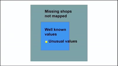
Do we need 11 000 shop=* values?
sotm2024
Data Analysis & Data Model
22 min
2024-09-08
72
Mateusz Konieczny
State of the Map 2024
22 min
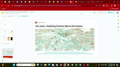
Cloud-native OSM for Visualization & Analysis
sotm2024
Data Analysis & Data Model
22 min
2024-09-07
28
Sajjad Anwar
and
Wille Marcel
State of the Map 2024
29 min
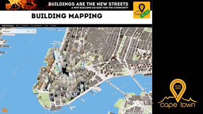
Buildings are the new Streets
Data Analysis & Data Model
29 min
2020-07-04
287
Felix Delattre
and
Danijel Schorlemmer
State of the Map 2020
19 min
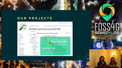
Geochicas OSM
General
19 min
2019-08-30
48
María Ballesteros
FOSS4G 2019
18 min
Open Street Map in Freiheit erstarrt?
Vorträge (OSM)
3.008
18 min
2013-06-13
2
Falk Zscheile
FOSSGIS 2013
29 min
OSM2World hinter den Kulissen
Freie Daten
GI Studio
29 min
2016-07-06
2
Tobias Knerr
FOSSGIS 2016
22 min
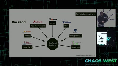
Das Geoportal des Guten Lebens
22 min
2018-12-29
426
Benedikt
,
Jana
and
Ralf
ChaosWest @ 35c3
19 min
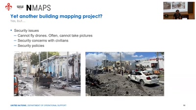
Crowdsourcing and virtual reality applications for peacekeeping: study cases in Mogadishu…
Software Development
OSM
19 min
2022-08-21
26
Michael Montani
State of the Map 2022
previous page
next page