System
Light
Dark
News
RSS, last 100
Podcast feed of the last two years
SD quality
Podcast audio feed of the last year
Podcast archive feed, everything older than two years
SD quality
News
RSS, last 100
Podcast feed of the last two years
SD quality
Podcast audio feed of the last year
Podcast archive feed, everything older than two years
SD quality
Search for "43" returned 3386 results
previous page
Sort by
Newest first
Oldest first
Relevance
next page
42 min
Add depth!
Stereoscopic imagery for everyone
Wood work instead of IT? - Leisure activities you developed during lock down
42 min
2021-08-21
121
Florian Haas
FrOSCon 2021 Cloud-Edition
38 min
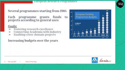
Involvement of OpenStreetMap in European H2020 Projects
OSM
OpenStreetMap
38 min
2021-07-11
12
Damien Graux
and
Thibaud Michel
State of the Map 2021
33 min
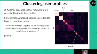
An Automated Approach to Identifying Corporate Editing Activity in OpenStreetMap
OSM
OpenStreetMap
33 min
2021-07-11
97
Veniamin Veselovsky
State of the Map 2021
41 min
Community Interactions in OSM editing
OSM
OpenStreetMap
41 min
2021-07-11
48
Dipto Sarkar
and
Jennings Anderson
State of the Map 2021
32 min
Towards a framework for measuring local data contribution in OpenStreetMap
OSM
OpenStreetMap
32 min
2021-07-11
48
Maxwell Owusu
State of the Map 2021
41 min
What has machine learning ever done for us?
OSM
OpenStreetMap
41 min
2021-07-11
297
Peter Mooney
State of the Map 2021
35 min
Mapping unmapped towns in Turkey by building and enlarging OpenStreetMap Turkey community
Community and Foundation
OSM
35 min
2021-07-10
44
Oğuzhan Er
and
Said Turksever
State of the Map 2021
26 min
Linting the map together: Collaborations of Mapbox Data RAVE and OpenStreetMap Communities
Community and Foundation
OSM
26 min
2021-07-09
25
Vlada Boitsik
State of the Map 2021
38 min
OSM data: Privacy Risks and GDPR compliance
Data Analysis & Data Model
OSM
38 min
2021-07-09
89
Robert Riemann
State of the Map 2021
16 min
MapaTanda: Mapping for and with the Ageing Population
Community and Foundation
OSM
16 min
2021-07-09
19
Kris Libunao
State of the Map 2021
22 min
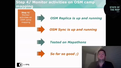
From global to local OSM mapping, CartONG’s overall OSM based strategy to support…
User Experiences
OSM
22 min
2021-07-09
18
Manon Viou
,
Olivier Ribiere
and
Martin Noblecourt
State of the Map 2021
20 min
Public Cloud Watcher
Cloud and Containers
20 min
2021-06-18
24
asmorodskyi
openSUSE Conference 2021
19 min
Abschluss der FOSSGIS-Konferenz 2021
Geo
OpenStreeetMap
19 min
2021-06-09
65
Jörg Thomsen
FOSSGIS 2021
5 min
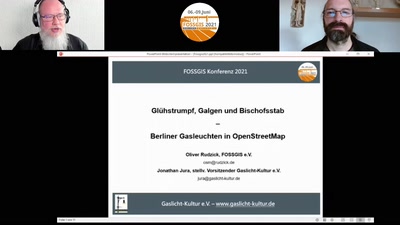
Glühstrumpf, Galgen und Bischofsstab - Berliner Gasleuchten in OpenStreetMap
OpenStreetMap
Geo
5 min
2021-06-09
71
Oliver Rudzick
and
Jonathan Jura
FOSSGIS 2021
45 min
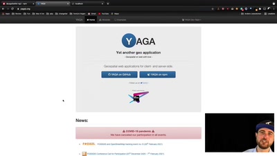
In 60 Minuten zur eigenen Geo-App mit YAGA leaflet-ng2
Kartographie und Visualisierung
Geo
45 min
2021-06-09
75
Stephan Herritsch
and
Arne Schubert
FOSSGIS 2021
28 min
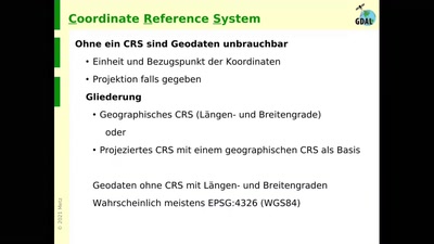
GDAL - Konzept und Werkzeuge
Neuigkeiten aus den Open-Source-Projekten
Geo
28 min
2021-06-09
82
Markus Metz
FOSSGIS 2021
5 min
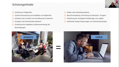
Erfahrungen mit Online-Schulungen freier GIS-Software in Zeiten der Pandemie
Ausbildung und Lehre
Geo
5 min
2021-06-08
42
Jörg Thomsen
FOSSGIS 2021
27 min
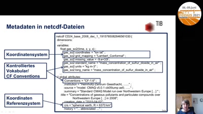
EASYDAB (Earth System Data Branding) - eine neue Kennzeichnung von qualitativ…
Offene Standards, z.B. INSPIRE, OGC
Geo
27 min
2021-06-08
20
Anette Ganske
FOSSGIS 2021
28 min
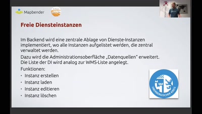
Mapbender 3.2 - besser denn je
Neuigkeiten aus den Open-Source-Projekten
Geo
28 min
2021-06-08
238
Olaf Knopp
FOSSGIS 2021
26 min
Erfassung und Visualisierung der Personenanzahl in Gebäuden unter Verwendung des…
Praxisberichte
Geo
26 min
2021-06-07
101
Pascal Neis
FOSSGIS 2021
25 min
Mit digitalen Naturschutzinformationen und OpenStreetMap ein nachhaltiges Verhalten in…
OpenStreetMap
Geo
25 min
2021-06-07
75
Sebastian Sarx
FOSSGIS 2021
25 min
Realisierung von konfigurierbaren WebGIS-Layern mit Opensource Software – ein…
Praxisberichte
Geo
25 min
2021-06-07
55
Marco Scheuble
and
Hümeyra Hubacher
FOSSGIS 2021
48 min
Konfiguration eines WFS-T mit MapServer und TinyOWS
Grundlagen Open-Source-GIS und OpenStreetMap
Geo
48 min
2021-06-07
125
Jörg Thomsen
FOSSGIS 2021
27 min
Geoprozessierung und Change Detection: Wie kann die GIS Welt von fernerkundlichen Daten…
Rasterdaten und Fernerkundung
Geo
27 min
2021-06-07
111
Till Adams
and
Guido Riembauer
FOSSGIS 2021
45 min
EGroupware - Neues in der Version 21.1
45 min
2021-04-10
99
Stefan Unverricht
Grazer Linuxtage 2021
previous page
next page