System
Light
Dark
News
RSS, last 100
Podcast feed of the last two years
SD quality
Podcast audio feed of the last year
Podcast archive feed, everything older than two years
SD quality
News
RSS, last 100
Podcast feed of the last two years
SD quality
Podcast audio feed of the last year
Podcast archive feed, everything older than two years
SD quality
Search for "FOSS4G" returned 312 results
previous page
Sort by
Newest first
Oldest first
Relevance
next page
14 min
gFlowiz, an open science framework to analyze and geovisualize networks and flow datasets
General
14 min
2019-08-28
56
Nicolas Roelandt
FOSS4G 2019
22 min
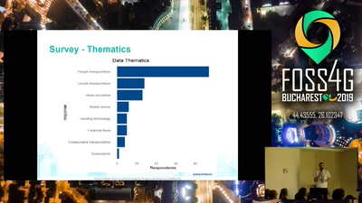
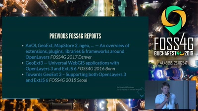
State of GeoExt
General
22 min
2019-08-28
170
Seth Girvin
,
Christian Mayer
and
Marc Jansen
FOSS4G 2019
22 min
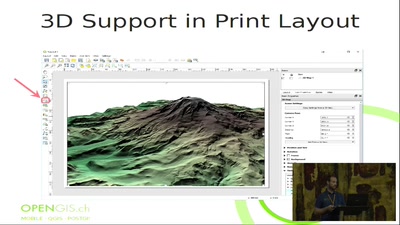
QGIS is dead, long live QGIS! - the very best new features of QGIS 3.x
General
22 min
2019-08-28
1.4k
Marco Bernasocchi
FOSS4G 2019
23 min
Geospatial open data for everyone, from global to local
General
23 min
2019-08-28
71
Nicolas Bozon
and
Dalibor Janak
FOSS4G 2019
22 min
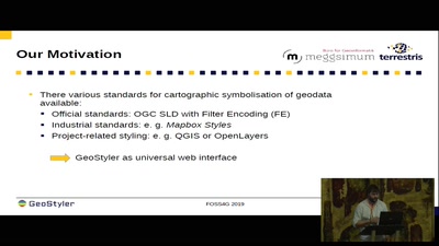
GeoStyler - a generic graphical style editor for geodata
General
22 min
2019-08-28
159
Christian Mayer
and
Till Adams
FOSS4G 2019
16 min
3D geo data in the Mapbox-gl viewer with 3D tiles
General
16 min
2019-08-28
910
Tom van Tilburg & Anne Blankert
FOSS4G 2019
25 min
Revamp of Coordinate Reference System management in the OSGeo C/C++ stack with PROJ and…
General
25 min
2019-08-28
205
Even Rouault
FOSS4G 2019
13 min
Interactive map of geospatial information in the City of Buenos Aires
General
13 min
2019-08-28
28
Ariel Anthieni
FOSS4G 2019
26 min
INSPIRE Reference Validator: status and next steps
General
26 min
2019-08-28
48
Belén Sáez
,
Iñaki Díaz de Cerio Paniagua
,
Carlos Palma
,
Enrique Soriano
,
Jon Herrmann
,
Clemens Portele
,
Michael Lutz
and
Marco Minghini
FOSS4G 2019
22 min
GeoServer WFS3: introduction to the RESTful, schemaless, JSON first download service
General
22 min
2019-08-28
487
Andrea Aime
FOSS4G 2019
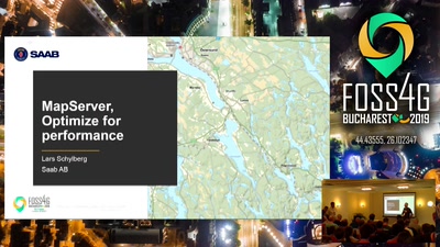
20 min
MapServer, Optimize for performance
General
20 min
2019-08-28
129
Lars Schylberg
FOSS4G 2019
23 min
Publication of Inspire Datasets as Linked Data
General
23 min
2019-08-28
39
Enrique Soriano
and
Rodríguez Pascual Antonio Federico
FOSS4G 2019
21 min
Data is USELESS!
General
21 min
2019-08-28
52
Lars Agerskov Christensen
FOSS4G 2019
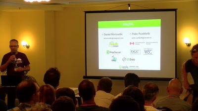
28 min
MapML: The (new) "map" HTML element, now in MapServer, GDAL and OGR
General
28 min
2019-08-28
130
Daniel Morissette
and
Peter Rushforth
FOSS4G 2019
24 min
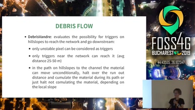
FOSS tools for modelling natural hazards: the HortonMachine library
General
24 min
2019-08-28
31
Silvia Franceschi
FOSS4G 2019
28 min
G3W-SUITE: a new framework for the QGIS projects WEB publication.
General
28 min
2019-08-28
236
Lami Leonardo
FOSS4G 2019
28 min
When building, maintaining & continuously improving a SDI isn’t enough: DevOps processes…
General
28 min
2019-08-28
37
Markus Neteler
,
Emmanuel Belo
,
Torsten Drey
and
Marc Jansen
FOSS4G 2019
26 min
I3S – an open standard to bring 3D to Web, Desktop and Mobile platforms
General
26 min
2019-08-29
79
Tamrat Belayneh
FOSS4G 2019
24 min
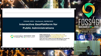
Interactive GeoPlatform for Public Administrations
General
24 min
2019-08-28
44
Andrea Pogliaghi
and
E. Cattaneo
FOSS4G 2019
16 min
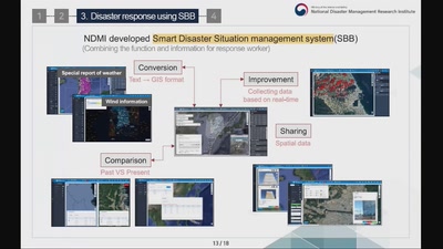
Establishment of Integrated Disaster Response System through the Analysis of Disaster…
General
16 min
2019-08-29
23
Jinyi Park
FOSS4G 2019
22 min
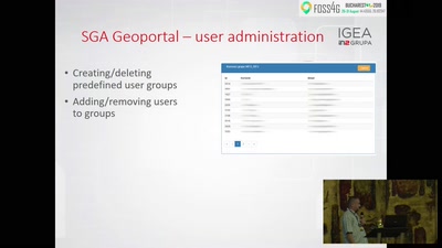
Users management, authorization and usage analysis on Croatian SGA Geoportal
General
22 min
2019-08-29
49
Dragan Podvezanec
FOSS4G 2019
25 min
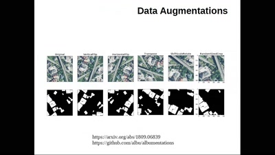
Computer Vision at scale with RoboSat.pink
General
25 min
2019-08-29
148
Olivier Courtin
FOSS4G 2019
25 min
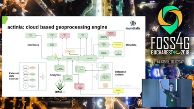
How digging in the earth for the fibre roll-out took GRASS to the cloud
General
25 min
2019-08-29
119
Markus Neteler
,
Markus Metz
,
Anika Bettge
,
Torsten Drey
and
Carmen Tawalika
FOSS4G 2019
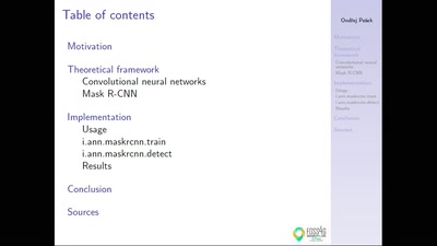
29 min
CNN-based tools in GRASS GIS
General
29 min
2019-08-29
341
Ondřej Pešek
and
Martin Landa
FOSS4G 2019
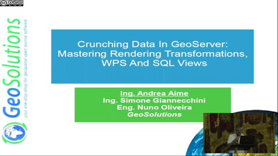
26 min
Crunching Data In GeoServer : Mastering Rendering Transformations, WPS Processes And SQL…
General
26 min
2019-08-28
150
Mauro Bartolomeoli
and
Andrea Aime
FOSS4G 2019
previous page
next page