Hyoung Seong and Park
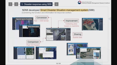
Korean government has launched the 'Public Safety Map' to provide safety information, with a web map service since 2013. It collects 160 pieces of information from 29 agencies, and compiles Public Safety Information maps in eight categories. In 2018, we analyzed performance and usage patterns to evaluate the use of the system. This analysis revealed that users were having difficulty in accessing the thematic map rather than the information itself. Users unfamiliar with the service had to click on the menu tree structure in order to find the desired topic, which resulted in a decrease in service utilization. It also became clear that it was difficult for users to find their desired thematic map, because there were over 214 service menus. In order to enhance accessibility through an improved user interface, we applied a new technology: a chatbot. Now users can find the desired thematic map and move to the area of interest through dialogue with the chatbot. As a result, where some thematic maps had previously taken up to eight levels (clicks) to display the thematic map, this was reduced to two levels by using the chatbot service. We plan to improve the chatbot service and continuously increase its utilization through user surveys .
None

